Cameron Long · 22 September 2026
Researchers Track How Rising River Levels Are Undermining Foundations of 19th-Century Smithies Scattered Along the Tyne Corridor
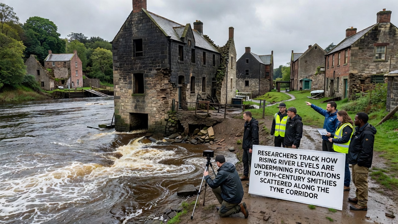
Teams from several universities and heritage organisations have begun systematic monitoring of how elevated water levels along the River Tyne are eroding the stone and brick foundations of 19th-century smithies that once supported the region’s industrial output. These structures, built during the height of local metalworking activity, sit on land that now experiences more frequent inundation and stronger current action because of broader changes in river flow and sea-level trends.
Historical Placement of Smithies Along the Corridor
During the 1800s, blacksmiths and forge operators positioned their workshops close to the Tyne to take advantage of water for cooling, power, and transport of coal and iron. Maps from that period show clusters of these buildings between Newcastle and the coast, many of them constructed directly on river terraces or low-lying ground that offered easy access to barges. Today those same locations place the remaining foundations within reach of normal high-water marks that have shifted upward over recent decades.
Monitoring Programme Launched in Response to Observed Changes
Researchers began installing sensors and conducting laser scans at twelve documented smithy sites in early 2025, with expanded fieldwork scheduled for September 2026 that will include drone surveys and sediment sampling after the summer flood season. The work combines data from the UK Environment Agency on river gauge readings with on-site measurements of foundation displacement, allowing direct comparison between water-level records and structural movement. Preliminary readings already show measurable undercutting at several locations where sandstone blocks have shifted several centimetres since the previous survey round.
One study released by Newcastle University researchers links the observed changes to a combination of gradual sea-level rise in the North Sea and altered rainfall patterns across the Tyne catchment. Their report notes that mean high-water levels at the tidal limit have increased by approximately 12 centimetres over the past thirty years, while peak flow events occur more frequently during winter months.
Methods Used to Quantify Foundation Damage
Teams employ a range of non-invasive techniques including ground-penetrating radar, photogrammetry, and repeated total-station surveys to track millimetre-scale movements without disturbing the archaeological deposits. At sites where timber piles remain embedded in the riverbed, divers record scour depths around each timber, producing three-dimensional models that can be compared year on year. These models reveal that erosion rates have accelerated at bends in the river where current velocity remains high even during moderate tides.
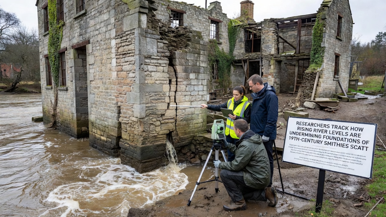
According to figures published by the Met Office, the North East of England has recorded a 7 percent increase in winter rainfall since the 1990s, contributing to higher river discharge and more frequent overtopping of historic river walls. When these events coincide with spring tides, water remains in contact with foundations for longer periods, accelerating both mechanical wear and chemical weathering of lime mortar.
Geographic Spread of Affected Sites
While teh most visible damage appears at locations downstream of Gateshead, similar patterns have been recorded as far upstream as Hexham, where smaller forges once served agricultural communities. Researchers note that the combination of tidal influence and increased fluvial sediment transport creates different erosion profiles depending on each site’s position relative to the tidal limit. Upstream structures experience more episodic damage during flood peaks, whereas downstream smithies face constant low-level saturation that weakens mortar joints over time.
Integration with Broader Climate and Heritage Data
Findings from the Tyne corridor align with observations reported by the Intergovernmental Panel on Climate Change in its 2023 assessment of coastal heritage risks, which highlighted increased vulnerability of low-lying industrial archaeology worldwide. A parallel project in the Netherlands, coordinated by the Cultural Heritage Agency, uses comparable sensor networks to monitor 18th-century shipyards along the Rhine, providing cross-regional benchmarks for erosion thresholds. Data sharing between the two programmes has allowed Tyne researchers to refine predictive models that estimate when intervention thresholds may be crossed at individual sites.
Next Steps for September 2026 Fieldwork
The expanded campaign planned for September 2026 will add real-time pressure sensors inside foundation voids at three priority locations, transmitting hourly readings to a central database. These instruments will capture the duration and depth of water penetration during both routine tides and storm surges, supplying the quantitative evidence needed for heritage management plans. Local councils and the Environment Agency are already reviewing preliminary results to determine whether temporary sheet-piling or vegetation reinforcement can slow further loss before permanent conservation decisions are made.
Conclusion
Continued monitoring will clarify how quickly the 19th-century smithy foundations along the Tyne are being compromised by rising river levels. The data collected through 2026 and beyond will inform both local preservation strategies and wider understanding of climate impacts on riverside industrial heritage across similar catchments.